The week after the canoeing trip we had a self-organized trip and Martynas and I decided to see some places in the south. On day one we took a bus from Kristiansand to Flekkefjord and from there to Åna-Sira. This was our starting point from where we hiked down to the area of the Brufjell potholes because it is a very beautiful area with an interesting history. A pothole is a smooth, cylindrical hole in the rock surface. The Norwegian word for pothole, “Jettegryte”, derives from one of the many old Norwegian words for trolls, “Jette”. In the old days it was believed that it was the trolls who had made these smooth kettles and caves in the mountains. Most potholes were formed by water in glacial rivers during the last ice age. The potholes at Brufjell is not formed by glacial rivers. Here it is the sea and the waves during the Tapes period that has eroded both the plateau and the potholes. The force and power of heavy ocean waves are immensely strong, strong enough to erode and dig into the bedrock. The potholes we visited here at Brufjell have probably been formed in a combined process of rotating stone and cavitation. Over several thousand years, the sea and the waves have grinded small and large stones against the bedrock, at the same time as the largest and heaviest storm waves have power enough to create a cavitation-effect like the Glacier Rivers have had.
After arriving at the coastline we had lunch and afterwards we started to hike around the area. In the end we hiked more than we had planned because we had enough time left to climb at a mountain of 224 m of altitude next to Ystebø. Following to this “detour” we hiked finally down to the potholes where we enjoyed the evening sun. Around 7ish we started our way back to Åna-Sira-Skole where we wanted to sleep somewhere because on the next morning the bus departed there quarter to eight. Unluckily we did not find a good spot to sleep first. The area was steep on the left-hand site of the street and on the right-hand one there were goat’s enclosures. We definitely did not want to sleep there. After we had spoken with one of the few people we met we decided to sleep right behind the school because it was closed. There we found a good spot with a 2m path in between two fences.
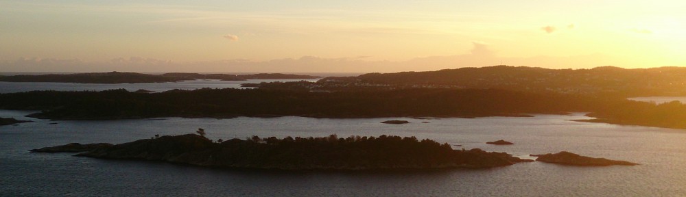
The next morning, we had to survive a 6 hour journey including three bus rides to Lindesnes. First, we took a bus back to Flekkefjord and killed the waiting time with a short visit of the city centre and a second breakfast next to the seaside. From Flekkefjord we took three more busses until we finally arrived at 16 o’clock at Nedre Våge. Following, we hiked down to the Lighthouse were we decided to hike first at a peninsula with is the most south point of Norway because of two reasons. First, there was a geocache and second, after 17 o’clock entering the area of the lighthouse is for free. So we avoided paying 50 NOK with a small hike to a peninsula where we had a great view over the lighthouse area. Due to the feeling of hunger we had a second lunch there as well. Five minutes past five we entered the lighthouse area and luckily we were able to go up the lighthouse and enjoy the overview for some minutes before the key keeper closed it. We discovered the bunkers in the area afterwards and broke off to hike the red marked costal path. This one was really beautiful with nice overview spots on various hill tops which showed us the beauty of this landscape. During the hike we watched out for places to build a shelter but we were not able to a flat and wind covered area. The biggest problem was to find a flat part because the grass was very hilly. This was very strange and I found no explanation for this until now and I have never seen such an area like this before. Nevertheless, in a small forest part we finally found a good spot to sleep. As it turned out there was an ant nest 10 meters ahead of us and a beaver dam 200m downhill at the lake but still we decided to sleep there. After finishing our shelter we grabbed our dinner stuff and hiked up one of the hills where we had a nice overview over the coastline. This was a perfect ending of the day – just sitting there with food and watching the sunset while listening to the waves and bird. I cannot imagine something better than this.
The next morning we woke up very early due to rainfall but we felt asleep again und the next time we woke up the rain was gone – luckily. As consequence, we were able to have breakfast in the sun, as well as hiking in good conditions. During our way back to Spangereid we saw a wild reindeer which surprised me. I did not expect them so deep in the south but this animal was definitely no deer and more horse like. Moreover we found excrement balls which were much bigger than the one of deer wherefore I think it must have been a reindeer. All day the weather was nice to us and we had just a few rain drops on the way but it was cloudier compared to the days before. From Spangereid we took a bus to Mandal where we arrived at almost 18ish. According tour plan we changed on Sunday, we did not take the bus home to Kristiansand. We stayed in Mandal and did some Geocaching and in the end we found three boxes and had a nice walk in the city centre and in addition we were shown two nice overview spots. We chose the second one and built our shelter at Kronheia where we had again a nice place for the night. The next morning we took life easy and slept in and enjoyed the view over Mandal while having breakfast. Following we broke up our shelter and took a bus home to Kristiansand.


")


