Area:

1 - Orienteering map Jegersberg
Jegersberg – it is a forest above the location of the University of Agder. Because of a lot of different paths, streams and hills which are spread all over the area and make it a physically challenging area, it can properly be used for Friluftsliv acitivites. For example hiking and solving orienteering tasks with map and compass. The picture on the right shows the orienteering map of Jegersberg. An orienteering map is much more detailed than a usual map and helps to navigate through the area.
Equipment:
- Usual packed daypack
It was additionally stressed to bring:
- Food and something hot to drink
- Rope
- Proper boots keeping feet warm and dry
- Something for sitting on
- Extra pair of dry socks
- Pencil and paper
- Compass
- Map and map protection
Task:
Norwegian and international Friluftsliv students were mixed and afterwards divided in four groups. Each group got a different post number which it should reach and come back to the starting point. Back at the starting point the team got a new number. This is called star orientation. In the end every group had to have visited the same points (4, 6, 11, 14) which can also be seen – marked by a red circle – at the following picture “Jegersberg, visited posts”.
3 - GPS Tracking Jegersberg

2 - Jegersberg visited posts
In addition to that a team had to find a piece of paper at each spot which told you a little exercise. They were also used by the organization of the fieldtrip to check if a post was exactly and not nearly found. If the paper said questions, they had to be written down and told to the lecturers at the starting point. The papers told the following tasks:
| Post | Task |
| 4: | Two people had to keep at least one leg of the ground on your way back. |
| 6: | Redirected to post 5 which had three questions about pop-culture/news |
| 11: | Explain 10 symbols or guidelines on a map |
| 14: | Five questions related to outdoor life |
Last but not least there was a little competition between all groups. The winning team were supposed to win a price. It was not told what it would be before.
Challenge:
In my opinion there were three challenging points:
- Area
The area Jegersberg is a physically challenge itself. We had to walk a distance of about 13-14 km and stay concentrated the whole time. On the one hand for avoiding to hurt ourselves or fall, on the other hand for not getting lost and losing orientation. That was a challenge for our bodies as well as our minds. The way we walked can be seen at the picture above “GPS Tracking Jegersberg” but it does not contain the way to post 14 because I forgot my mobile at the starting point on our first run. The measured distance is 11,84 km, up 204 m, down 208 m and the maximum reached height is 106m.
- Competition
Due to the fact that the whole trip was in competition with the other teams, everybody walked faster than usual. That was an additional burden for concentration.
- Weather
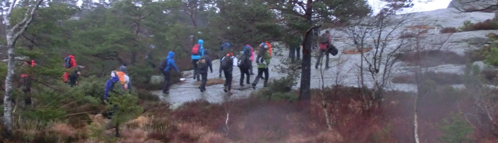
It was raining the whole day very heavily and the temperature was very low. Most people were already wet after reaching the first post. Maybe this was the hardest challenge of the day because the weather did not only claim everybody physically it was also a hard task for everybody’s mind due to the loss of motivation. One group even broke up the fieldtrip because they got too cold.
Personal comment:
In my opinion the whole trip was very well organized by the Norwegian students. Everybody had the possibility to improve his or her orienteering skills and work together with the other people of the team. The weather was a trial of everbody’s motivation but at least it proofed your gear. For me the best of the day were the little tasks at each spot and the competition. In the end team one won and shared its price, two bags of sweets, with all remaining students. Great day, thank you! =)