Coastal Sea Field Trip
Randøya – 31/05-02/06

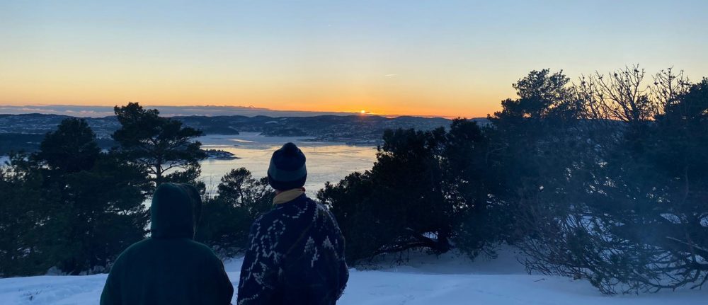
Due to Corona restrictions our last trip of the program was shortened to only 2.5 days and we stayed within our international class and again did not meet the Norwegian class. But still I must say it was the best trip on the last half a year – with sun, summer temperatures, and long light nights. We learned to use the sea and the coastline as a playground for all kind of different activities and learnings. Randøya is an island south east of Kristiansand. In the 2nd World War Germany used Randøya as a apart of the Atlantic wall. Nowadays it is a recreational island and used for friluftsliv classes and lectures and you can still visit the old military barracks. Kjetil gave us a cultural history guided tour through the barracks and the old command centre of the island. We were allowed to stay in the old houses and use the kitchen and bathroom facilities. So starting the program with sleeping in the snow in minus temperatures, cooking with gas stoves and only bring the most necessary stuff because you have to carry everything on your back to being allowed to sleep in bunk beds, cook in a huge kitchen and bring all the gear we want to.
Kayaking (with Thomas)
Our group of 6 started with kayaking. Because it was already the second time for us to go sea kayaking in our program, all of us already had a basic knowledge of how to steer a kayak. Half of our group was more experienced in kayaking and done more paddling before than the other three. As a group it was our task to decide what were are going to focus on for the next 2.5h lecture with Thomas. We decide on a combined trip around the area and some stroke and paddling exercises. We started our trip at our jetty in Kalvøyfjord through Tangesund and headed through Vesterfjorden, Kirkesund, around Indre Kalvøya, through Kalvøysund backt to Kalvøfjord and around Bulholmen. For exercising we looked for calm water and a wind sheltered bays.
The right and efficient way of paddling:
The first and biggest mistake most people do when starting paddling is that they are doing small cycling movements with their paddle and pulling it with a lot of force backwards. This is really exhausting and only uses your triceps and biceps. Instead of that you should try to focus more on pushing the paddle forwards and every time you finish one stroke both of your hands should cross the middle sector of the kayak and be more or less in a line on one side. When doing this you are automatically doing a rotation with your upper body and using your core which is a way much less exhausting especially when you plan to go on a kayak trip for several days.
Edging:
To steer your kayak you can use edging to easily change your direction. Means when trying to steer more to the right you lift up your right knee, your kayak will lean to the left side and the surface of the kayak which touches the water will change. If you hold this position for a longer time (not just for a few seconds) your front will move to the right side. In addition to that you can add a C-stroke (starting in the front and “drawing” a C in the water with your paddle) on your left side.
Rudder:
Another way of changing direction is to use your paddle as a rudder either in the front or in the back. For the front rudder you have to bring your paddle into the water at the very front the front side of the blade facing towards your kayak (other way round you would use it for a stroke). In slightly opening the blade you can feel the force of the water and the resistance. If you open it to much there is to much force and you will break (Not efficient because you slow down and need more effort to get your speed back).
For the back rudder you can use it at the end of a stroke either in opening up the blade away from the kayak – which will move your front to the opposite side or you use it in addition with a c-stroke letting the blade face the kayak – which will move you more to the side where your paddle is in the water.
Deep-water rescue:
When capsizing it is very important to never let go of your paddle and kayak. A capsizing person is very likely to panic and by trying to hold on to another boot capsizing that boot too. So for you as a “rescuer” it is very important to stay away first if the person is panicking and try to calm her/him down. The panicking person can then hold on to your front “hugging” the boat while you grab the capsized boat turn it back and try to pull it on top of your own kayak in front of you (this will look like a plus). You can then turn the kayak towards you and by leaning back let the water flow out of the kayak. Push the kayak back in the water and align it with your kayak the other way round to your own (back to front). Lean on and put weight on the other kayak. The

person in the water can now grab on to their own kayak and start crawling from the back on top of the own kayak and sit back in.
Motorboat (with Kjetil)
This session we started with a little map reading lecture. We all got a map from the area and everyone had to point out one important symbol/detail.
- Lighthouses: Red and green light indicates danger – do not go into this direction. White light (on maps marked in yellow) marks safe areas.
- Chart numbers: Each number indicates the waters lowest depth (MLLW) in an area.
- Shallow waters:
- star – rocks visible (at low tide)
- plus with dots – rocks just beneath the surface or awash even at low tide
- plus – rocks underneath surface at all the time
- Buoys:
- Red and green buoys are marking a channel from or towards a port. When travelling from open waters towards a port red buoys (black sword on maps) should always stay on your right (starboard). When travelling towards open waters green buoys (white swords on maps) should always stay on your right (starboard).
- Isolated Danger Marks are marked with a black pin needle on a map. They indicate an isolated area of danger with f.ex. rocks underneath. If there is a little flag pointing in one direction it indicates the deep water side where you can go or stay.
- Red zig zag lines: marking power lines
- 5kn = 5 knots à 1 Kn 8 kmh (remember it easily: x2)
The right of way based on classification: Work – Muscle – Wind – Motor
Always identify where another boat is relative to your own:
- If another vessel is approaching you from the port — or left — side of your boat, you have the right of way and should maintain your speed and direction.
- If a vessel is aiming to cross your path and they’re on your starboard — or right — side, they have the right of way.
- Any vessel that is approaching your boat for the stern doesn’t have the right of way. Maintain your speed and course. When a boat is overtaking another, the vessel in front always has the right of way and should be allowed to continue their original course.
After that we learned the basics how to start and drive a motorboat.
- Neutral gear
- Engine safety cut-off: automatically turns the engine off if you leave the boat for any reason, attach the secure line on your life jacket
- Remove all the lines securing the boat to the jetty
- By pulling the handle out you can give the engine more fuel for the first start
- Pushing the throttle handle gently forward or backward to shift gear
- Docking the boat: gently in a 45° angle, turning into neutral when getting close

Biology Shallow Water (with Svein)
Armed with dip nets, waiters, buckets and water glasses we went to a bay. We were supposed to go through the tidal water and collect and “hunt” all kind of interesting animals, plants, mussels, snails etc. in the buckets.

After one hour of playing around we met up all together and identified what we found. Because one girl from our group did a gap year and did voluntary work in a nature protection area nearby the Baltic Sea – she knew a lot about the life in tidal waters. So Svein and she played around with English, German and Norwegian names of species.
We found:
Shrimps, Crabs, Sea alga, …
Mussels: Common Cockle (Herzmuschel), Blue Mussel (Miesmuschel), Pacific Oyster, Atlantic Jackknife Calm (amerikanische Schwertmuschel)
Snails: Littorinidae (Strandschnecke), Crepidula fornicata (Pantoffelschnecke), Chiton (Rändel-Käferschnecke)

We cooked some of the snails and mussels in salt water and ate them. When you want to eat them it is important that you check whether they are safe to eat. Svein had an app on his phone marking all the beach areas around Norway and marking with red (do not because there is too much alga at the moment which the mussels and snails eat) and green (safe area) whether you can eat them at the moment.
On a little walk to the south cliffs, we found wild chive and caught red algae (which you can cook and eat as well).
Rowing (with Petter)
That they there was really stormy and a rough ocean with wind from the east. Because of the shapes of the surrounding islands, the wind in our bay was also searching for another way and coming through the fjord from the north. Meaning there was always a stream into the open water.
In the small rowing boats we used were two seats the front being the motor and giving the rhythm and the person in the back being the brain. You always row backwards which means you have to turn your neck to see where you are going.
Fishing
As we wanted to have fish for dinner we needed to catch some first. We talked to Petter to get some tips and tricks. He suggest us not to go to the pier but more to the cliffs in the south and also differentiate your location. And YOU have to HUNT the fish – so its not about just waiting but also watching out for movements and for the fish!
